Citrus County Manatee Zones, Refuges and Preserves
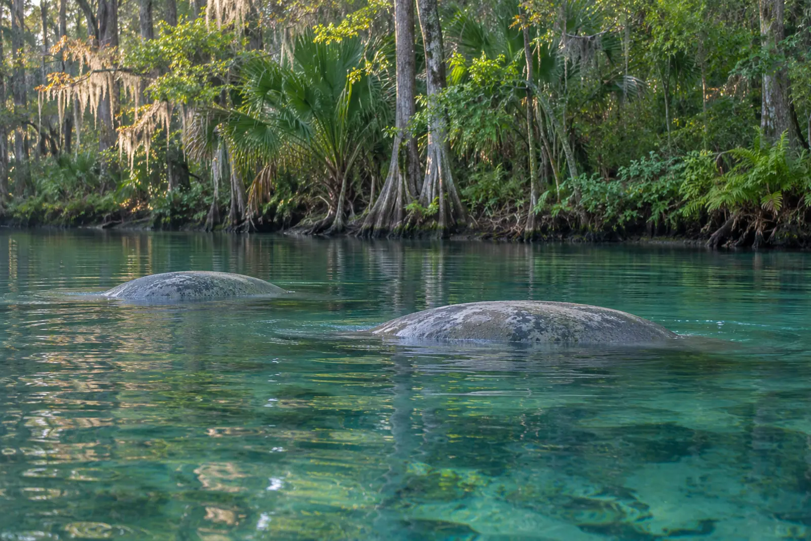
Citrus County waters carry two overlapping layers of protection: federal rules set by the US Fish and Wildlife Service inside the two national wildlife refuges, and state speed zones established under the Florida Manatee Sanctuary Act by FWC. Both apply at the same time and both carry serious penalties. Zone boundaries are not obvious from the water — carry current maps before you run.
Independent guide, not a club, dealer, outfitter or agency, and not affiliated with any organisation that previously used this domain. Rules on the water change — confirm anything legal with the Florida Fish and Wildlife Conservation Commission before you run.
Citrus County manatee zones: how the system works
Four types of restriction appear on these waters. Idle speed means the minimum engine speed needed to maintain steerage with no visible wake. Slow speed means the vessel is fully off plane with minimal wake — faster than idle but noticeably slower than planing. No entry means no waterborne access of any kind. Maximum speed zones cap vessels at 25 mph or 35 mph in designated corridors. Many zones are seasonal; others run year-round. The state zones and the federal refuge rules are separate legal instruments and can stack on top of each other.
Crystal River National Wildlife Refuge and Kings Bay
Crystal River National Wildlife Refuge is the only national wildlife refuge in the United States established specifically to protect the Florida manatee, according to the US Fish and Wildlife Service. The refuge manages Kings Bay and its connected spring-fed waters. Florida manatees concentrate here in winter because the springs hold a constant 72 °F year-round.
Seven named manatee sanctuaries inside Kings Bay are closed to all waterborne activities from November 15 through March 31. Their names and approximate sizes, as listed in 50 CFR § 17.108:
- Banana Island Sanctuary — 3.41 acres
- Sunset Shores Sanctuary — 5.62 acres
- Magnolia Springs Sanctuary — 3.4 acres
- Buzzard Island Manatee Sanctuary — 18.0 acres
- Tarpon Springs Manatee Sanctuary — 4.6 acres
- Warden Key Sanctuary — 4.0 acres
- Three Sisters Spring Sanctuary
Boundaries are marked by buoy lines.
Outside the sanctuaries, Kings Bay carries a mix of year-round and seasonal speed zones. During September 1 through April 30, most of the bay is under slow speed or idle speed restrictions depending on the specific area; the northeastern bay, including Magnolia Shores and Cedar Cove, carries idle speed year-round. From May 1 through August 31, posted maximum speed zones apply in designated areas of the bay. Year-round prohibitions on chasing, touching, diving on, or disturbing manatees apply throughout Kings Bay regardless of season or zone type.
Three Sisters Springs
Motorized vessels are never permitted inside Three Sisters Springs in any season. Paddle craft and swimmers may enter from April 1 through November 14. From November 15 through March 31 all boats — including kayaks and canoes — are prohibited under the Three Sisters Spring Sanctuary closure in 50 CFR § 17.108.
Chassahowitzka National Wildlife Refuge
Chassahowitzka NWR covers coastal waters in both Citrus and Hernando counties. Vessel use on the refuge is subject to both federal refuge rules and the state manatee zones that apply to the Chassahowitzka River and its tributaries. Airboat restrictions at Chassahowitzka are more limiting than those for conventional boats; contact the refuge through fws.gov/refuge/chassahowitzka for current airboat route and permit requirements before you plan a run.
State speed zones under the Florida Manatee Sanctuary Act
Florida Administrative Code Chapter 68C-22.011 sets state manatee zones for Citrus County and adjoining parts of Hernando and Levy counties. The main zones, by water body:
- Kings Bay: Multiple zones — slow speed and idle speed restrictions apply in various parts of the bay September 1–April 30; posted maximum speed zones in designated areas May 1–August 31; idle speed year-round in the northeastern bay including Magnolia Shores and Cedar Cove.
- Homosassa River: 25 mph maximum year-round in the main marked channel. Idle speed year-round in canal and creek areas; slow speed October 1–April 30 (25 mph maximum May 1–September 30) in upper river reaches including Price Creek.
- Blue Waters area, upper Homosassa River: No entry, November 15–March 31. Idle speed outside that period. This area adjoins Homosassa Springs State Wildlife Park.
- Florida Power Corporation effluent canal (Crystal Bay area): Slow speed, November 15–April 30.
- Chassahowitzka River: Slow speed, April 1–August 31; 25 mph maximum the rest of the year.
- Withlacoochee River: Multiple sections carry year-round restrictions. In the designated lower river zones and Bennetts Creek: slow speed, March 1–August 31; 25 mph maximum, September 1–February 28.
- Coastal Gulf waters between the Withlacoochee entrance and the Johns Island line, within 1,000 feet of shore: 25 mph maximum, year-round.
The FWC manatee protection zones page lists the full regulatory text and links to county maps.
State aquatic preserves
St. Martins Marsh Aquatic Preserve covers the coastal waters of Citrus County from Crystal River in the north to the Chassahowitzka NWR boundary in the south, taking in a chain of offshore islands including the St. Martins Keys. Seagrass is a legally protected resource within it: propeller scarring carries a fine of up to $1,000 under Florida law, according to the Florida Aquatic Preserves programme. The shallow grass flats that make airboating attractive in this area are the same flats that enforcement covers. For more on where airboats can legally run in this region, see where to run an airboat in Citrus County.
Airboat rules in protected areas
Both national wildlife refuges restrict airboats more tightly than conventional boats. At Crystal River NWR, airboat access is limited to a designated route and requires a USFWS Special Use Permit obtained in advance — contact the refuge through fws.gov/refuge/crystal-river before you plan a run. At Chassahowitzka NWR, airboat access is similarly permit-restricted; check fws.gov/refuge/chassahowitzka for current route and permit requirements. Running over marsh vegetation is prohibited in both refuges.
Penalties
Exceeding a posted manatee zone speed limit is a noncriminal infraction under Florida law. Harming, harassing, capturing, or killing a manatee is a federal violation under the Marine Mammal Protection Act and the Endangered Species Act, carrying criminal penalties including significant fines and up to one year of imprisonment per incident. Seagrass propeller scarring inside an aquatic preserve carries a civil fine of up to $1,000 per incident under Florida law.
Finding current zone boundaries
Zone boundaries exist in two authoritative forms. For state zones, FWC publishes downloadable GIS data for each county at geodata.myfwc.com, available in KML format compatible with most chartplotters. For federal zones inside the refuges, boundary maps for Crystal River and Chassahowitzka are on the respective refuge pages at fws.gov. Refuge visitor centres also carry printed maps. Posted buoys can be missing or displaced after storms; loading the KML file on your plotter before you leave the ramp is more reliable than relying on water markers alone. See how seasons and water levels affect where you can run for guidance on timing trips around the heaviest enforcement windows.
Frequently Asked Questions
Are airboats allowed in Crystal River National Wildlife Refuge?
Airboat access inside Crystal River NWR is restricted to a designated route and requires a USFWS Special Use Permit issued in advance. Operating an airboat over marsh vegetation anywhere in the refuge is prohibited at all times. Contact Crystal River NWR directly through fws.gov/refuge/crystal-river to apply for a permit before you plan a run.
When do Citrus County manatee zones become active each year?
The seven Kings Bay sanctuaries close on November 15 and reopen April 1. The Blue Waters no-entry zone on the Homosassa River is also active November 15 through March 31. The Homosassa River seasonal slow speed zones begin October 1. Chassahowitzka River slow speed zones run April 1 through August 31; the designated Withlacoochee lower zone slow speed period runs March 1 through August 31. Seasonal zones are defined in Florida Administrative Code 68C-22.011.
What is the difference between idle speed and slow speed?
Idle speed means the lowest engine setting at which you can maintain steering — no visible wake. Slow speed means the vessel is fully settled off plane with minimal wake; it is typically faster than idle but far slower than cruising speed. Both are distinct from a no-entry zone, where no vessel may enter. Carrying the wrong understanding of these terms is a common and expensive mistake in Kings Bay and the Homosassa River.
Can I take a boat into Three Sisters Springs?
No motorised vessel is permitted inside Three Sisters Springs in any season. Kayaks and canoes may enter from April 1 through November 14, but are excluded November 15 through March 31 along with all other watercraft under the Three Sisters Spring Sanctuary closure.
Where can I get a current map of Citrus County manatee zones?
FWC publishes county-level manatee zone maps and downloadable KML files at myfwc.com and at geodata.myfwc.com. Federal sanctuary boundaries for Kings Bay are on the USFWS Crystal River refuge page at fws.gov/refuge/crystal-river. Refuge visitor centres carry printed maps. Load the KML on your chartplotter before you launch; posted buoys on the water are not a reliable substitute for the current regulatory data.